Home > Europe > United Kingdom > England > London > Sights > Trent Park
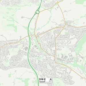
North East Derbyshire S18 2 Map

![]()
Wall Art and Photo Gifts from Map Marketing
North East Derbyshire S18 2 Map
Postcode Sector Map of North East Derbyshire S18 2
Media ID 19980364
Alexandra Road Aston Close Avon Close Beech Way Bents Lane Cecil Avenue Cecil Road Chesterfield Road Derwent Road Egerton Road Fairview Road Falcon Road Green Lane Haddon Close Hardwick Close Hartington Road Hawthorne Avenue Holmesdale Road Langdale Drive Linden Avenue Marsh Avenue Mill Lane North East Derbyshire Oakhill Road Paddock Way Park Avenue Parkgate Princess Road Sheffield Road Summerfield Road Sycamore Avenue The Avenue The Knoll The Lawn Thirlmere Drive Dronfield Holmesdale
FEATURES IN THESE COLLECTIONS
> Europe
> United Kingdom
> England
> Avon
> Europe
> United Kingdom
> England
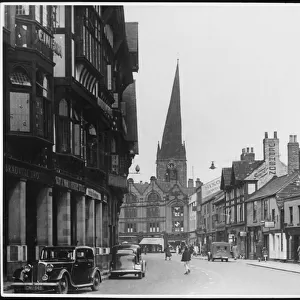
> Derbyshire
> Chesterfield
> Europe
> United Kingdom
> England
> Derbyshire
> Dronfield
> Europe
> United Kingdom
> England
> Derbyshire
> Hassop
> Europe
> United Kingdom
> England
> Derbyshire
> Related Images
> Europe
> United Kingdom
> England
> London
> Sights
> Trent Park
> Map Marketing
> Postcode Sector Maps
> S - Sheffield
> Maps and Charts
> Related Images
MADE IN THE USA
Safe Shipping with 30 Day Money Back Guarantee
FREE PERSONALISATION*
We are proud to offer a range of customisation features including Personalised Captions, Color Filters and Picture Zoom Tools
SECURE PAYMENTS
We happily accept a wide range of payment options so you can pay for the things you need in the way that is most convenient for you
* Options may vary by product and licensing agreement. Zoomed Pictures can be adjusted in the Cart.