Home > Fine Art Storehouse > Map
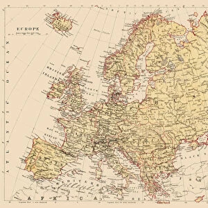
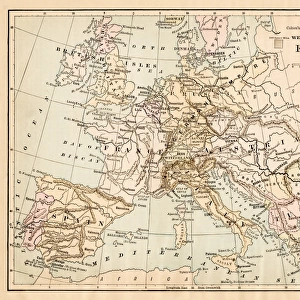
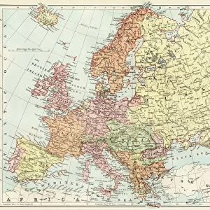
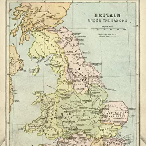
Europe map 1881

![]()
Wall Art and Photo Gifts from Fine Art Storehouse
Europe map 1881
Harpers School Geography, New York, Harpers and Brothers, 1881
Unleash your creativity and transform your space into a visual masterpiece!
THEPALMER
Media ID 14756076
© This content is subject to copyright
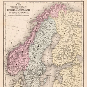
Austria Denmark Norway Portugal Russia Sweden
FEATURES IN THESE COLLECTIONS
> Fine Art Storehouse
> Map
> Denmark Maps
> Fine Art Storehouse
> Map
> Historical Maps
> Fine Art Storehouse
> Map
> Italian Maps
EDITORS COMMENTS
In this print titled "Europe map 1881" we are transported back in time to an era when cartography was both a science and an art form. The detailed map, sourced from Harpers School Geography, New York, published by Harpers and Brothers in 1881, offers us a glimpse into the geopolitical landscape of Europe during that period. The intricate lines and delicate shading beautifully depict the borders of countries such as Portugal, Austria, Denmark, France, Germany, Italy, Norway, Russia, Spain, Sweden – each with its unique shape and character. As we explore this vintage map further with our eyes tracing the contours of the continent's diverse topography – from majestic mountain ranges to winding rivers – we can't help but marvel at the meticulous craftsmanship involved in creating such a comprehensive representation. This particular print has been skillfully curated by THEPALMER for Fine Art Storehouse. It serves as a testament to their commitment to preserving historical artifacts through stunning visual mediums. With every glance at this piece on your wall or desk space comes an opportunity to immerse yourself in European history while appreciating the artistic beauty inherent within these old-world maps. Whether you're an avid traveler seeking inspiration or a history enthusiast yearning for connection with past generations' journeys across Europe's lands - this remarkable print is sure to captivate your imagination and spark curiosity about how our world has evolved over time.
MADE IN THE USA
Safe Shipping with 30 Day Money Back Guarantee
FREE PERSONALISATION*
We are proud to offer a range of customisation features including Personalised Captions, Color Filters and Picture Zoom Tools
SECURE PAYMENTS
We happily accept a wide range of payment options so you can pay for the things you need in the way that is most convenient for you
* Options may vary by product and licensing agreement. Zoomed Pictures can be adjusted in the Cart.